cas/definition.php (people or term)

Fitness Landscape
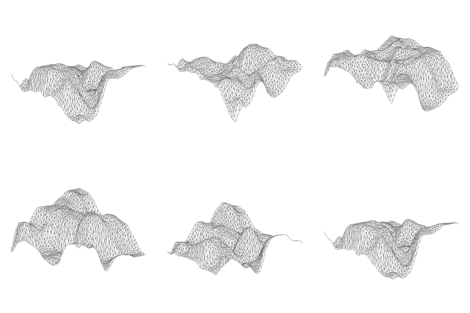
A fitness landscape is a concept that employs the metaphor of a physical landscape to depict more or less 'fit' regions of phase space.
Related Terms and Topics: Fitness Peaks, basins-of-attractions, critical-point, Tipping Points, Phase Space
A fitness landscape is not a physical space. It is a way of describing the range of all possible behaviors open to a system, or its Phase Space. Agents within a Complex System may have the capacity to behave in a wide variety of ways, but some of these are more efficient than others. The landscape is a metaphoric mapping of how well different states within a system's degrees of freedom perform. We picture the fitness landscape as being composed of a series of hilly plateaus of different heights. This performance is measured as Fitness, with more 'fit' states being mapped higher within the landscape, or as Fitness Peaks.
Again, it may be helpful to illustrate with an example:
Example: At one point, Detroit was a 'fit' site for gaining employment, due to the auto-industry. Subsequently, with shifting global production trends, the forces that made Detroit 'fit' altered, and its 'peak' within the landscape of potential employment gradually eroded.
The interesting about a fitness landscape is that there are multiple peaks. We can think of these as multiple niches that are ripe for inhabitation. Different species can pursue different survival strategies to fill these niches. Some strategies can support a large population of species (think of this as a broad and tall hill). Others may able to eke out an existence, but their niche may only support a small number of species. This peak might be equally tall, but would be narrower.
The idea of a fitness landscape serves to illustrate the broader concept of Fitness within a Complex System.

This is tantamount to a system's Degrees of Freedom.
Exploration or Exploitation
It is very interesting to think about how best to explore a fitness landscape.
Imagine that you camping in a hilly landscape, without a map, and you plan to go for a hike. It is morning on a cloudy day, and you can see different foothills around, you, but due to the cloud cover you can't see the tops of the hills The sun is expected to break through later in the afternoon and you want to find yourself on the tallest peak with the "fittest" or best view. You begin to wander randomly and make a decision that you will follow whatever pathways seem to be taking you higher at each step. After many hours of wandering, you find yourself on a plateau where you cannot move further without your footsteps taking you down. You stop there, have a drink, and wait for the sun to come out. When it does, you realize that you are at the top of a hill, but that, in the distance, are other hills with taller peaks. You climbed to a local optima, but your random steps failed to take you to the global optima within the landscape. You became trapped on the peak you selected at the start.
Unfortunately, in this scenario, while you were able to explore part of the landscape, you did not get an adequate overview of the situation to choose that section of landscape well.
There are a number of ways to help solve this problem, and this can be done using an exploration strategy called "simulated annealing". Simulated annealing combines broad exploration at the start of an exploration sequence, with more focused exploration at the end of an exploration of a sequence.
Cite this page:
Wohl, S. (2022, 6 June). Fitness Landscape. Retrieved from https://kapalicarsi.wittmeyer.io/definition/fitness-landscape
Fitness Landscape was updated June 6th, 2022.
Nothing over here yet
Navigating Complexity © 2015-2025 Sharon Wohl, all rights reserved. Developed by Sean Wittmeyer
Sign In (SSO) | Sign In
Related (this page): Tactical Urbanism (17), Tipping Points (218), Information (73), Fitness (59),
Section: terms
Non-Linearity
Related (same section):
Related (all): Urban Modeling (11, fields), Resilient Urbanism (14, fields), Relational Geography (19, fields), Landscape Urbanism (15, fields), Evolutionary Geography (12, fields), Communicative Planning (18, fields), Assemblage Geography (20, fields), Tipping Points (218, concepts), Path Dependency (93, concepts), Far From Equilibrium (212, concepts),
Nested Orders
Related (same section):
Related (all): Urban Modeling (11, fields), Urban Informalities (16, fields), Resilient Urbanism (14, fields), Self-Organized Criticality (64, concepts), Scale-Free (217, concepts), Power Laws (66, concepts),
Emergence
Related (same section):
Related (all): Urban Modeling (11, fields), Urban Informalities (16, fields), Urban Datascapes (28, fields), Incremental Urbanism (13, fields), Evolutionary Geography (12, fields), Communicative Planning (18, fields), Assemblage Geography (20, fields), Self-Organization (214, concepts), Fitness (59, concepts), Attractor States (72, concepts),
Driving Flows
Related (same section):
Related (all): Urban Datascapes (28, fields), Tactical Urbanism (17, fields), Relational Geography (19, fields), Parametric Urbanism (10, fields), Landscape Urbanism (15, fields), Evolutionary Geography (12, fields), Communicative Planning (18, fields), Assemblage Geography (20, fields), Open / Dissipative (84, concepts), Networks (75, concepts), Information (73, concepts),
Bottom-up Agents
Related (same section):
Related (all): Urban Modeling (11, fields), Urban Informalities (16, fields), Resilient Urbanism (14, fields), Parametric Urbanism (10, fields), Incremental Urbanism (13, fields), Evolutionary Geography (12, fields), Communicative Planning (18, fields), Rules (213, concepts), Iterations (56, concepts),
Adaptive Capacity
Related (same section):
Related (all): Urban Modeling (11, fields), Urban Informalities (16, fields), Tactical Urbanism (17, fields), Parametric Urbanism (10, fields), Landscape Urbanism (15, fields), Incremental Urbanism (13, fields), Evolutionary Geography (12, fields), Feedback (88, concepts), Degrees of Freedom (78, concepts),
